Welcome to Laser Pointer Forums - discuss green laser pointers, blue laser pointers, and all types of lasers

LPF Donation via Stripe | LPF Donation - Other Methods

Links below open in new window

ArcticMyst Security by Avery

Frankenstorm

Joined
Mar 27, 2011
Messages
14,125
Points
113
Flooding, and fallen trees.

Along the coasts, the storm surge was more than anyone was expecting. Yes it was only category 1, but combined with high tide, it was far more than what the infrastructure was ever meant to handle. There quite literally has never been a storm like this before.

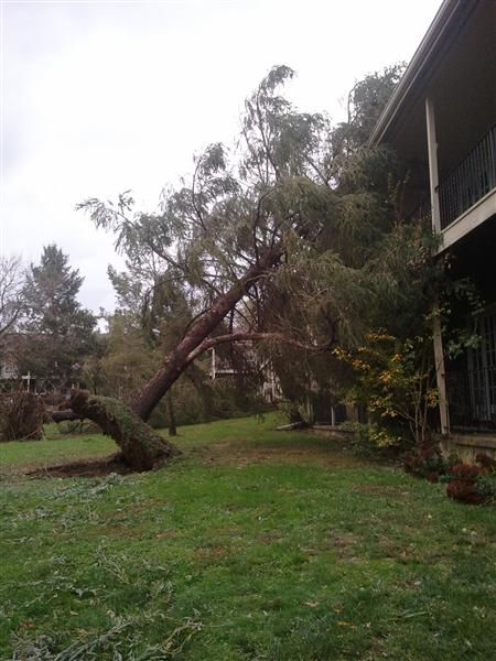
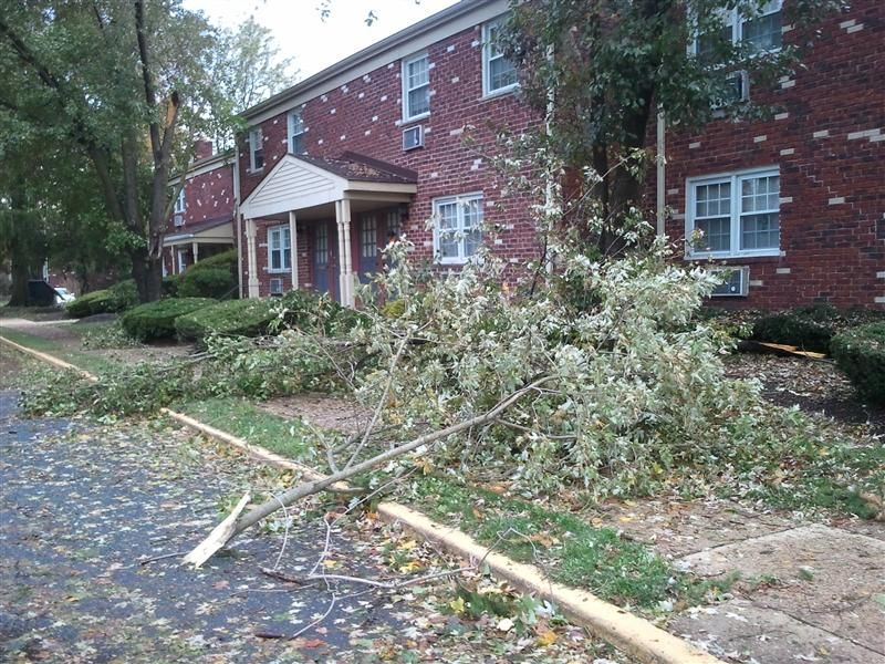
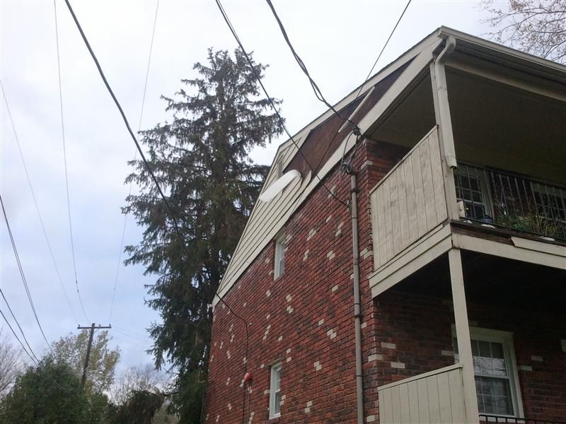
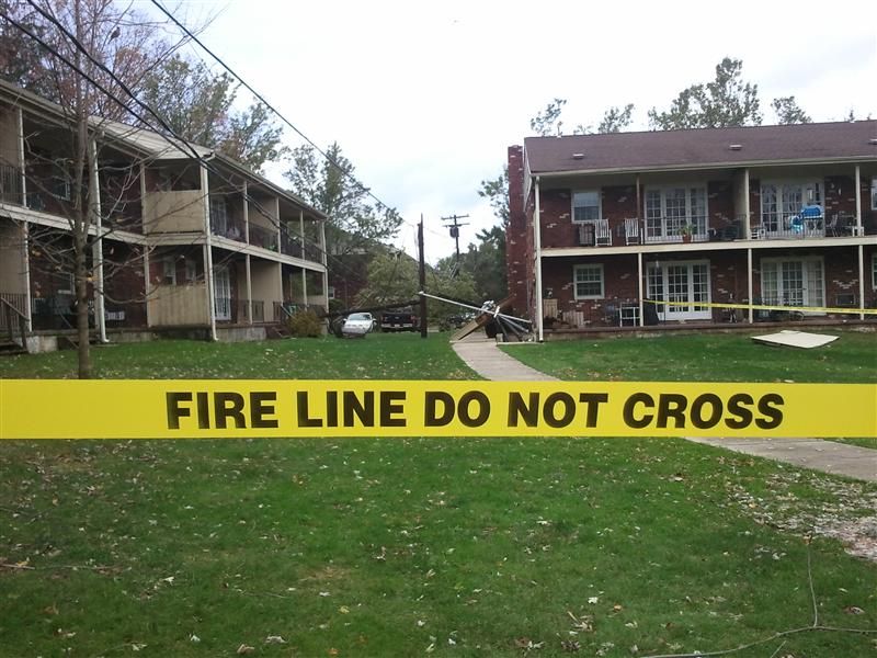
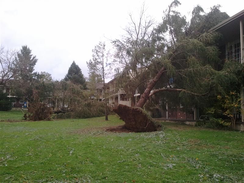
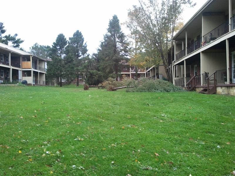
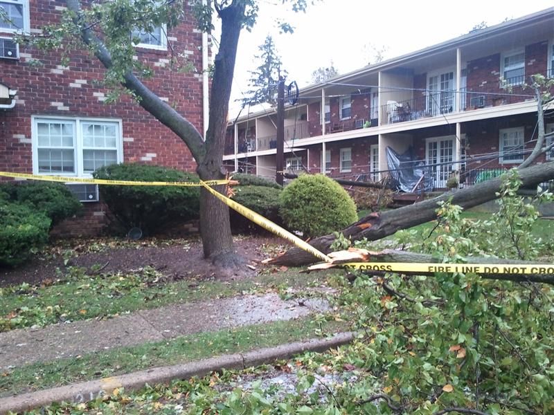
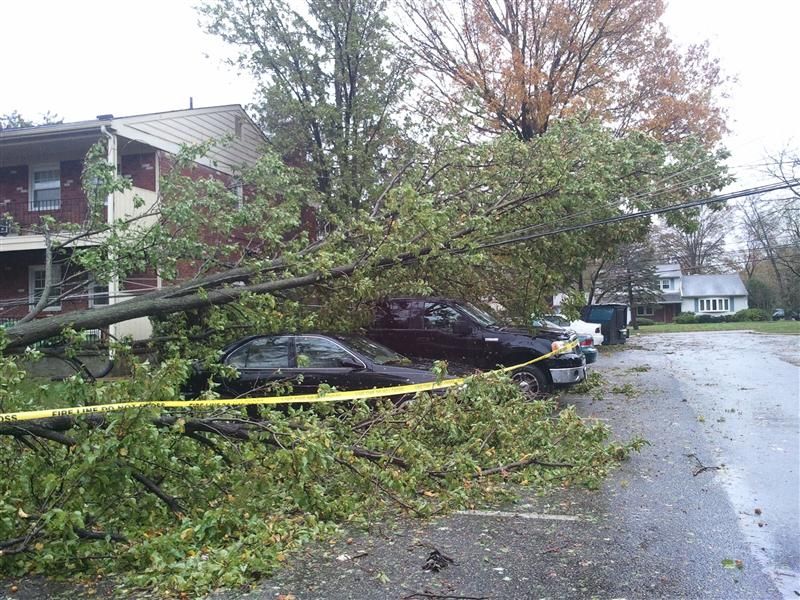
Inland the biggest problem by far is from fallen trees. The wind didn't take off any roofs, or push in windows, but there are a lot of very old, very heavy trees around... too many will not be becoming any older.

I don't know about Australia, but here, for the most part all the wires are strung along telephone poles, so when the trees fell, wires, and poles went down too.

Along with all of this, the amount of rain dumped caused flooding along all rivers, however small. The one next to my office is barely a brook, maybe five feet across, three feet deep, and it had to rise at least ten feet... which it did.

By far the worst damage is along the coasts. I know many of the boardwalks that have been destroyed, it's something that's hard to truly accept.

The fact of the matter is nothing was built to withstand this kind of a situation. It would be akin to you having a blizzard with five feet of snow, and a week of well below zero temperatures.
 
Last edited:


Things

0
Joined
May 1, 2007
Messages
7,517
Points
0
I'd love some snowfall and sub 0 temps here for once, always too friggin hot. But yes, I can see how devastating it'll be to somewhere not really intended for such storms. It's kind of like a heap of Japan's coastal towns being built below sea level during that huge tsunami/earthquake combo.

And yes, most of our powerlines are still strung up on poles, though most of my suburbs lines are underground. I think they finally got the hint after cyclones tearing them down every 2 years or so, underground lines just make so much more sense in places like here.
 
Joined
Mar 27, 2011
Messages
14,125
Points
113
It's kind of like a heap of Japan's coastal towns being built below sea level during that huge tsunami/earthquake combo.

Exactly. If the storm surge was a few feet lower, New York wouldn't have been affected anywhere near as much. Most of the towns along the coastlines... just a few feet above water. One of the things that's not getting nearly as much attention about new york, is that downtown many subway lines are badly, badly flooded. It will be over a month before they are back up and running. Meanwhile literally millions of people relied on them transportation on a daily basis.

Tunnels also didn't fare well, I've driven through this one many times...

Brooklyn%20Tunnel.jpg

the-brooklyn-battery-tunnel-flooded-with-water_4152807.jpg


For reference:

hugh-carey-tunnel.jpg


And this is just interesting...

20121030_flood2.jpg


In many places the sand has been washed several blocks inland.

Complete recovery will take months. For the coastal areas, probably years.

There are some ideas on preparation in the works (giant inflatable plugs coupled with more water pumps) but personally I can't conceive of how it is possible to guard against something like this hurricane without absolutely massive infrastructure projects.
 
Last edited:

daguin

0
Joined
Mar 29, 2008
Messages
15,989
Points
113
@ Things --

In addition to the storm surge, another reason why there was so much damage from a category 1 storm was its sheer size
The storm was about 1000 miles across :drool:

Peace,
dave
 

Things

0
Joined
May 1, 2007
Messages
7,517
Points
0
She's quite pretty for a cat1, usually you don't see any kind of decent eye formation until around high cat2.

Winds wouldn't have been so wide in that, but that is a lot of moisture around the outside that would have produces a lot of rain, as you can tell from the pics, along with the storm surge.

The storm surge is usually the biggest issue though. There was a small island resort right in the path of Yasi, went through the eye. Was reports of fridges floating ashore days after, the island had almost been completely covered in water from the 5m+ surge. It's insane seeing pics after you've actually seen the place before the destruction.

It's the official cyclone season here now since yesterday, so you can send any future hurricanes down this way please :D
 
Last edited:
Joined
Aug 3, 2012
Messages
1,209
Points
113
Still no power in my town. Getting gas is a nightmare around central nj
My wife works around exit 6 on the turnpike and there are no lines at all for gas so she has filled up both our cars without any wait. Of you live on nj it would be easier to take arise down the turnpike to 7A and gas up down there
Lines for gas this morning were at least a mile long
No power At work but we are working and since the business I am in is traffic cones we are crazy busy selling thousands of cones

My iPhone has become my office and is being charged on my car
I hope when I get home I have power

One good thing, fed ex and USPS are working so I should get my 2 lasers next week
Good luck to all
 

daguin

0
Joined
Mar 29, 2008
Messages
15,989
Points
113
Superstorm Sandy: By the Numbers - weather.com


  • Share
  • Tweet
  • 0

sandy-wind-field-28oct12-11p_650x366.jpg
National Hurricane Center
Surface wind field of Hurricane Sandy on Oct. 28, 2012 at 11pm ET. Orange shading indicates areas of tropical storm-force sustained winds. Red shading depicts hurricane-force sustained winds.


932


Sandy was the latest in a recent long line of large hurricanes, including Isaac from August 2012.
According to the National Hurricane Center's 11pm advisory on Oct. 28, 2012, tropical storm-force sustained winds spanned a diameter of 932 statute miles from southwest to northeast across Sandy's center of circulation. This is roughly the driving distance from New York to Jacksonville.
This mammoth tropical storm-force wind field was more than double that of both Isaac and Irene at their peak extent (450 and 460 miles, respectively), and even exceeded the tropical storm-force wind fields of both Hurricanes Ike and Katrina, although those had much higher wind speeds.
(MORE: Sandy vs. Irene)


There will be many PhD's earned by writing up the unique characteristics of this storm


Peace,
dave
 
Joined
Jan 8, 2009
Messages
3,145
Points
83
Of course, densely populated areas are effected most negatively just because of being densely populated.... MORE things to damage and the cross section of people effected rich, poor, homeless.
 
Last edited:

ped

0
Joined
Nov 25, 2008
Messages
4,889
Points
113
I hope they get things back to normality soon, and I feel for all the families that have suffered loss.

Hurricane Sandy: first person report
Something about wind or rain or ... hnnnnggg...


daguin

0
Joined
Mar 29, 2008
Messages
15,989
Points
113
It is so sad that we couldn't hear what she was saying ;)

Peace,
dave
 
Joined
Mar 27, 2011
Messages
14,125
Points
113
Still lots of people without power :(

My brother took these of the area around his apartment complex... he is without power for six, going on seven days:

2012-10-30161218Custom.jpg

2012-10-30161938Custom.jpg

2012-10-30161643Custom.jpg

2012-10-30161621Custom.jpg

2012-10-30161230Custom.jpg

2012-10-30161041Custom.jpg

2012-10-30084350Custom.jpg

2012-10-30084251Custom.jpg


Came across this online, looks a tad too familiar for comfort...

3ilhH.gif
 
Last edited:


Top